Premature Works
Select parcels:
Works Type:
 Estimate of Premature Lighting
 Estimate of Premature Paving
 Estimate of Premature Concrete
 Estimate of Premature Hydro
Value Results
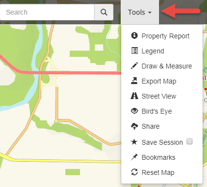
Export Map
Map Title:
Map Style:
Map Quality:
File Type:
Force map to scale 1:
Hide Address Labels (Aerial imagery only)
Draw & Measure
Show Measurement
Distance Units:
Area Units:
Distance Units:
Area Units:
Mailout & Reports
Select parcels:
Buffer Units:
Report Type:
Owners, occupiers, and businesses as held in Tidemark. Separated into 3 sheets: on-site addresses; non-resident owners; and businesses. Owners at the same address are grouped. Stata parking spots, CNV owned properties and duplicates are removed

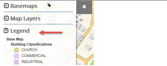

 CityMap